The Gumerovo Canyon and Buzha-Tau Mount

Fig. 1. The general view on the Buzha-Tau Mount and Gumerovo Canyon from the west. Photo by G. Danukalova

Coordinates: 53°33'4.84"N, 56°34'31.66"E (Buzha-Tau Mount).

Category: Projected complex (geological, geomorphological, botanical) natural monument.

Uplands of the right bank of the Zigan River, composed of Carboniferous limestones, belong to the Ishimbai State Nature Reserve, formed by the Decree of the Council of Ministers of the Bashkirian Autonomous Soviet Socialist Republic dated March 19, 1971 No. 119 “On the Organization of the Ishimbai State Reserve”.

On the territory there is a complex (geomorphological) natural monument “Ziganovka Cave and its environs” (Decree of the Council of Ministers of the Bashkirian Autonomous Soviet Socialist Republic dated December 26, 1985 No. 212 “On the protection of wild plants in the Bashkirian Autonomous Soviet Socialist Republic”).

Location: southeast of the Gumerovo Village, Ishimbai district, Bashkortostan Republic.

A Map 1. The Buzha-Tau Mount and Gumerovo Canyon are demonstrated on the topographic map. Scale is given on the map.

The characteristic of the natural complex and the importance of the natural monument..


Geomorphological characteristics

The Gumerovo Canyon and Buzha-Tau Mount are located southeast of the Gumerovo Village (Maps 1-3, Fig. 1). The Gumerovo Canyon is a bright example of a mountain valley formed by Zigan River, which crosses the advanced sub-meridional ridges of the western slope of the Southern Urals and goes out from the mountains to the hilly-plain Fore-Urals.

Front ridge height is approx. 420 m; the western slope of the ridge is steep, with numerous outcrops of bedrocks of the Carboniferous system. Buzha-Tau Mount (425.3 m) is an erosive remnant of an advanced mountain range, separated from it.

The river valley, hills and front ridges of the Southern Urals as negative and positive landforms formed during the Quaternary (the last 2.6M years) as a result of the denudation-erosional and slope processes under a general uplift of the territory because of neotectonic activity.

The thalweg height of the Zigan River is 208 m above sea level; the width of the riverbed at low water is approx. 20 m, the ford depth is up to 0.5 m, the flow velocity is 0.4 m/s, the bottom is rocky, silting along the riverbanks. The Zigan River valley is V-shaped in the narrowing areas near Buzha-Tau Mount and upstream from the mouths of Kanguba River and Brish River and slightly expanding between the mouths of Utyelga and Kanguba rivers, where a small intermountain depression was formed. Zigan River is the right tributary of Belaya River and belongs to the Volga hydrographic basin. The Total length of the river is 98 km.

Karst processes are active in carbonate rocks on the territory – there are many caves (nature monument Ziganovka Cave), grottoes, there is a karst arch on the Brish River, sink holes, funnels.

A Map 2. The Buzha-Tau Mount and Gumerovo Canyon are given on the satellite photograph (Google Earth). Excursion objects located in the canyon are shown on the space image: 1 – Buzha-Tau Mount; 2 – Muksim Mount; 3, 4, 5 – Carboniferous deposits outcrops; 6 – Gumerovo Horizon stratotype in the Abiuskan ravine; 7 – Zilim River valley; 8 – Ziganovka Cave; 9 – Stone Arch on the Brish River; 10 – Brish collapsed cave; 11 – Grotto: 12 – A Cave
A Map 3. The Buzha-Tau and Muksim Mounts – the gate to the Gumerovo Canyon – are given on the satellite photograph (Google Earth)
A Map 4. The geological map for the Sikasya-Zigan river basin vicinities (from the Geological map of the USSR. Plane N-40-XXI. 1:200,000 scale. South-Urals series / I.I. Sinitsyn and Z.A. Sinitsyna, A.I. Olli (Ed.). 1962)

Geological characteristics

Carbonate rocks of the Devonian and Carboniferous systems are represented in the erosional riverside cliffs of Zigan River valley upstream from Gumerovo Village (Map 4; Figs. 2, 3, and 8). Quaternary fluvial deposits (sand, pebble, gravel and loam) occur in the river valley.

The front ridge and Buzha-Tau Mount are composed of limestones and dolomites, which were formed in the Serpukhovian time of the Early Carboniferous, Bashkirian and Moscovian time of the Middle Carboniferous (Figs. 1, 2, and 4). These rocks can be seen in rock outcrops along the right side of Zigan River valley.

The carbonate rocks of the Serpukhovian Stage (Lower Carboniferous) form the lower part of the front ridge (Fig. 4), and they are represented by gray limestones, dolomites, accumulated in a shallow sea basin about 330–323 Ma ago. The brachiopod key species Striatifera striata Fisch. was found in the upper part of the Stage. Fossils are foraminifera and brachiopods. Visible thickness of the stratum is about 50 m.

During the Bashkirian time (Middle Carboniferous), from 323–315 Ma ago, the accumulation of carbonate rocks continued in shallow sea conditions (Fig. 5). The thickness of the Bashkirian deposits is about 300 m. Fossil remains are foraminifera and brachiopods. For example, the species Varistaffella ziganica (Fig. 6) is described directly from the thin section of the limestone of the Zigan section.

Fig. 2. A summary stratigraphic section of the Middle – Upper Carboniferous at the Toratau Geopark territory. Legend: 1–7 – limestones: 1 – layered, 2 – massive, bioherm, 3 – organogennous and bioclastic, 4 – with pea siliceous nodules, 5 – with siliceous layers and lenses, 6 – oolitic, 7 – clayer; 8 – bituminous, 9 – siliceous-clay lime rocks, 10 – dolomites, 11 – argillites, 12 – sandstones, 13 — foraminifera, 14 – algae, 15 – bryozoans, 16 — brachiopods, 17 – crinoids, 18 – corals, 19 – ammonoids; 20 – tentaculites, 21 – sedimentation breaks; 22 – transgressive boundary
Fig. 3. The Zigan River valley near the Gumerovo village. The right slope of the valley is composed of the Serpukhovian and Middle Carboniferous carbonate rocks. Photo by E. Kulagina
Fig. 4. The exposures of the Serpukhovian and Bashkirian stages on the right slope of the Zigan River valley (Muksim Mount). Photo by E. Kulagina
Fig. 5. The exposures of the Bashkirian Stage on the right slope of the Zigan River valley. Photo by E. Kulagina

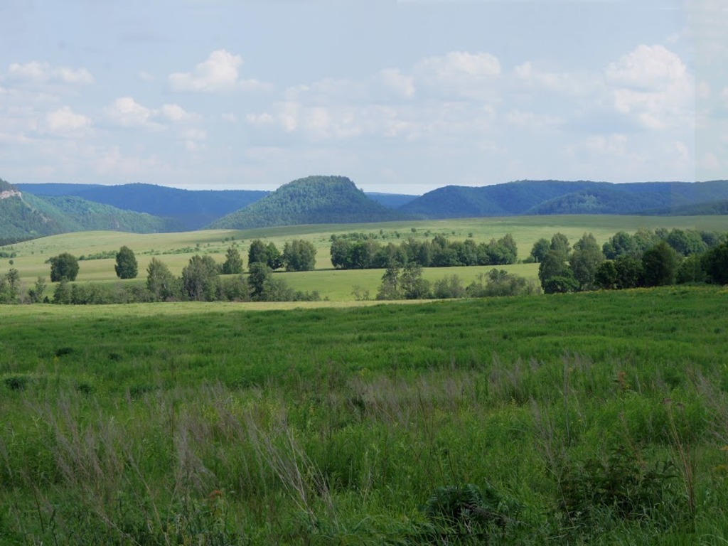
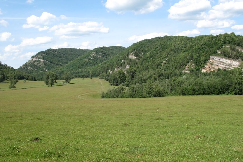
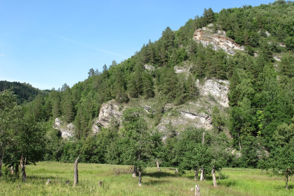
In Moscow time (315–307 Ma ago), the conditions remained the same – carbonate rocks accumulated in the sea basin. Dolomites and limestones with flint lenses are represented in the outcrop upstream 2 km southeast of Gumerovo village (Fig. 7).

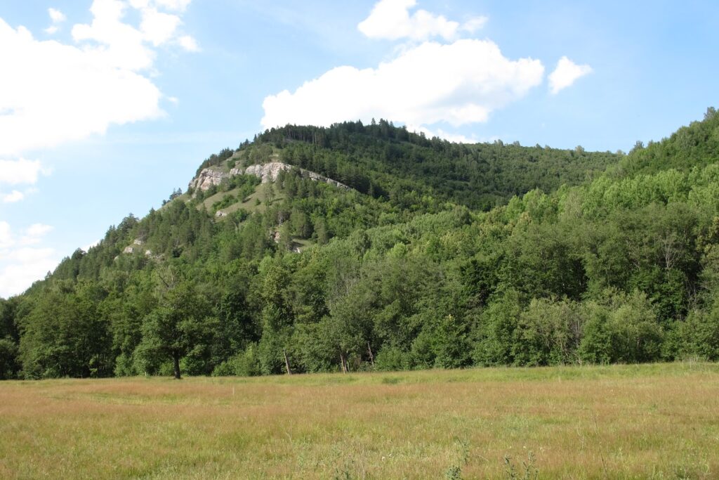
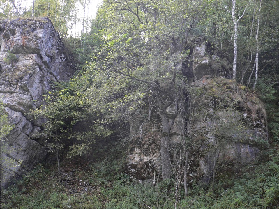
If you go deep into the Gumerovo Canyon past the mouth of Brish River to the north, you may see rocky outcrops of more ancient rocks belonging to the Devonian system.

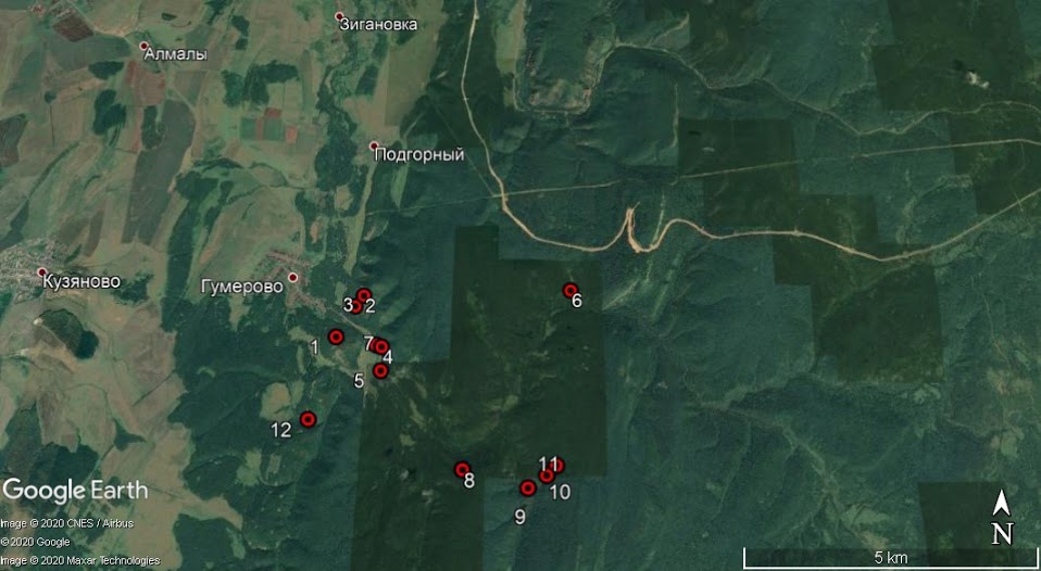
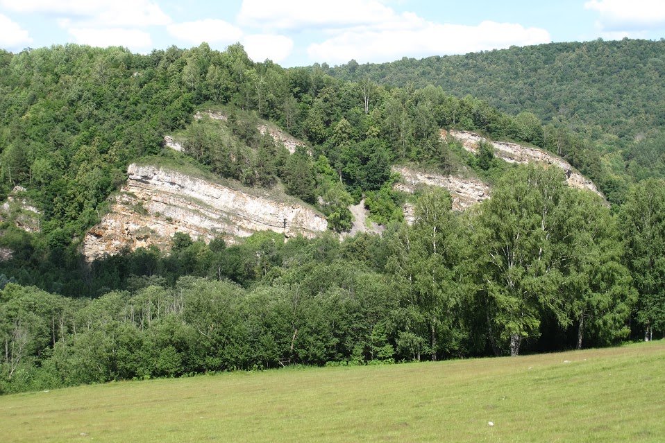
The section of the Upper Famennian Stage of the Devonian and the Tournaisian stage of the Lower Carboniferous is described on the right side of Zigan River in the Abiyuskan ravine, 4 km above Gumerovo village (Fig. 8). It has important scientific significance, since it is the standard section (stratotype) of the Gumerovo Horizon, which represents the boundary interval between systems. 

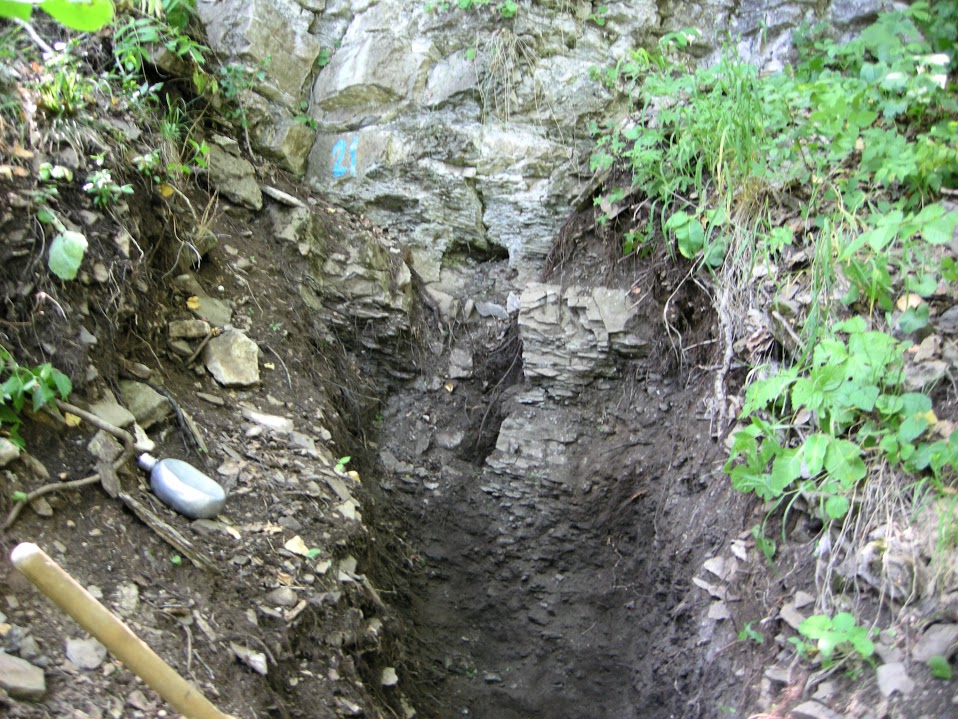
The horizon is characterized by a small thickness of 1.1 m, but there is a change in the complexes of many faunal and floral groups. A characteristic layer of loose carbonate-clay rock of brownish and dark gray color is noted in the middle part of the horizon (Fig. 9). This layer reflects the so-called global Hangenberg event, which was described in the sections of Western Europe and is associated with a short-term change in sedimentation conditions and the restructuring of the palaeoecosystems. 

The thickness of the Devonian limestones is about 57 m, the Tournaisian deposits (Lower Carboniferous) – about 30 m.

Fossil remains are algae, foraminifera, corals, gastropods, ostracods, bryozoans, brachiopods, crinoids, conodonts, and fish teeth

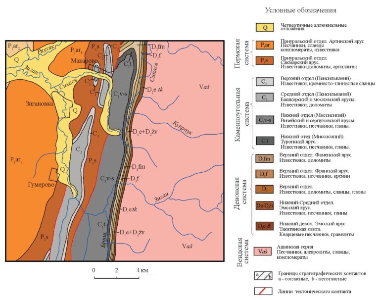
The front ridge of the Southern Urals near Gumerovo village structurally corresponds to the northern tip of the Arlarovo anticline, elongated submeridionally. The anticline is a large fold with a steep fall of up to 80 degrees on the western wing, sometimes complicated by a steep thrust. The eastern wing is more gentle with the fall of layers at an angle of 10–20 degrees. The fold was formed during the formation of the Ural Mountains as a result of a collision of continents.

Рис. 6. Фораминифера Varistaffella ziganica (Sinitsyna, 1975), осевое сечение раковины. Башкирский ярус, средний отдел каменноугольной системы. Фото Е. Кулагиной.
Fig. 6. An image of the foraminifera Varistaffella ziganica (Sinitsyna, 1975), axial section of the test. Bashkirian Stage, Middle Carboniferous. Photo by E. Kulagina
Fig. 7. The outcrop of the Moscovian Stage on the right slope of the Zigan River valley upstream from Gumerovo village. The Bashkirian and Moscovian stages boundary is fixed in the lower part of the outcrop. Photo by E. Kulagina
Fig. 8. The exposure of the Famennian Stage of the Devonian in the section along the right side of the Abiyuskan ravine (“Zigan” section). The Gumerovo Horizon is located in the upper part of the slope (behind the trees). Photo by V. Pazukhin

Botanical characteristics

Mixed broad-leaved forests, which are typical for the western slope of the Southern Urals, dominate in the Gumerovo Canyon area. Tilia dominates in forests; Quercus, Betula, Ulmus, Acer and Populus tremula exists as admixture species in the forests. Pine forests grew on the carbonate rocks. There are small areas of the rocky steppe. Rare plant species are: Parietaria micrantha (Ledeb.),  Fritillaria ruthenica (Wikstr.), Stipa pennata L., Tulipa biebersteniana Schult. et Schult., Primula cortusoides L.,  Dianthus acicularis Fisch. ex Ledeb., Lathyrus litvinovii Iljin, and  Lathyrus gmelinii Fritsch. (Fig. 10).

The object has scientific, aesthetic, recreational and environmental significance.

Fig. 9. The stratotype of the Gumerovo Horizon (“Zigan” Section). The clay layer corresponding to the Hangenberg event was opened by a trench. Photo by E. Kulagina
Fig. 10. Rare plants that need protection, growing in the Gumerovo Canyon (according to Volkov, Sokolov, 2015)

The protection regime is established for the part of the territory that belongs to the Ishimbay State Nature Reserve. The nature reserve protection regime is established by the Regulation on State Nature Reserves in the Bashkortostan Republic, approved by Resolution of the Cabinet of Ministers of the Republic of Bashkortostan dated February 26, 1999 No. 48, and the Regulation on Ishimbay State Natural Zoological Reserve, approved by resolution of the Government of the Republic of Bashkortostan dated January 28, 2008 No. 13 “On approval of regulations on state natural zoological reserves of republican significance.”

G.A. Danukalova, E.I. Kulagina, E.M. Osipova.

The material was prepared jointly with the Institute of Geology of the Ufa Federal Research Center of the Russian Academy of Sciences (RAS)


Text to us

Заявка

Your message has been sent! The Geopark press service will try to answer as soon as possible!